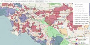
 Click here for a web mapping application that allows you to explore several dimensions of mixing across Southern California including income, age, racial composition, housing characteristics, and land use. This application corresponds to MFI’s Quarterly Report “Understanding Mixing in
Neighborhoods and its Relationship with Economic Dynamism.”
Tag: Apps
Explore the web app on Employment Subcenters in Southern California (Job Density)
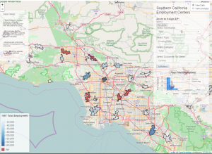 Click here for a web mapping application that allows you to explore the changing dynamics of employment centers in Southern California. This application corresponds to MFI’s Quarterly Report “Detecting Job Density Over Time.” Note: the webmap titled, “Employment Dynamics Across Southern California Cities” presents these same data but for cities rather than subcenters.
Explore the web app on Employment Dynamics Across Southern California Cities
This web mapping application e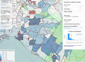 xplores job growth and localized employment specialization at the city level in five key economic sectors: business services, retail, industry, technology, and “creative” work. Note: this webmap presents the same data as the “Employment Subcenters in Southern California” webmap, but for cities rather than subcenters.
Explore the web app on Understanding Business Churning Dynamics and their Spatial Variation
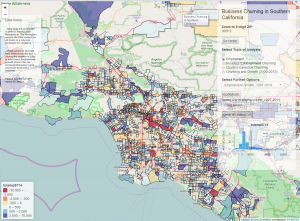 Click here for a web mapping application that allows you to explore the relationships between business churning, job growth, and clustering across Southern California.